

Maps, Knowledge, and Power in Medieval and Renaissance Europe
Maps are a representation of geographical space. As such, they are valuable as a source of information. Yet their makers can also use them to control or alter perceptions of that same information. In the 14th and 15th centuries, cartography, or the science of map-making, changed rapidly due to the explorations of the Americas. Use the maps below to trace some of these changes.
Primary Sources:
Mappa mundi, Hereford, c.1300
Annotation: The Hereford mappa mundi, or map of the world, is part of an ancient map-making tradition. Maps in medieval Europe were typically produced by religious men and represented a particularly Christian, Euro-centric point of view. These maps were not used for navigation, but rather to demonstrate ideas about the world.
- What does the map represent?
- What countries or regions does it show?
- What is missing?
- What is in the center of the map? Why?
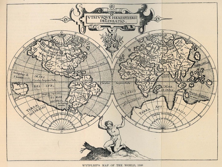
Universalis Cosmographia, Martin Waldseemuller, 1507
Annotation: Martin Waldseemuller (c.1470-1521) was a German cartographer. His map was part of a project to incorporate all of the new geographic information obtained by explorers to the New World. Waldseemuller represented a new, humanistic way of perceiving the world that was based upon Ancient Greek traditions. Waldseemuller, and other cartographers in this period, saw medieval map-making as fanciful and based upon myth rather than human knowledge. (This map has also become famous because it is the first-known use of the designation America.)
- How is Europe represented?
- How are the Americas represented? What sections are most detailed
- Look at the way Europe is shown as compared to the New World. What does this tell you about what Europeans believed they knew about the New World?
Representation of North America, John Senex, London, 1710
Annotation: By the 18th century, modern map-making was born. Cartographers based their maps upon the reports of sailors and explorers, and also upon the results of their own survey work.
- Where is the map most detailed?
- Where is the map least detailed?
- How did mapmakers represent lesser known areas?
Secondary Sources:
Monmonier, Mark S. How to lie with maps, 2nd edition. Chicago: University of Chicago Press, 1996.
Monmonier brings a critical eye to the science of cartography, using a range of examples to show how cartographers must distort the information they present to represent a three-dimensional world on the page. A useful survey by a geographer about how to analyze and understand map-making.
Thrower, Norman J.W. Maps & civilization: Cartography in culture and society. Chicago: University of Chicago Press, 1996.
A concise survey of the history of cartography.
Grafton, Anthony, with April Shelford and Nancy Siraisi. New worlds, ancient texts: The power of tradition and the shock of discovery. Cambridge, MA: Harvard University Press, 1992.
Originally accompanying an exhibition, this richly illustrated book conveys the intellectual impact of the age of exploration on European thinkers.
In the Classroom
Present your students with two different maps. Have them compare and contrast what they see.
– What is at the center of the map?
– What is at the edges?
– Where is the most detail?
– Where is the least detail?
– How are these maps different from the maps we use today?
Enduring Understanding
– What can maps tell us about how people have understood their world?
– How did the “discovery”? of the Americas change European perceptions of the world they inhabited?
– What motivated European powers to invest in map-making? How do the resulting maps reflect those interests?
Relevant Standards:
National History Standards (UCLA)
-Three Worlds Meet (Beginnings to 1620)
- Standard 2A: The student understands the stages of European oceanic and overland exploration, amid international rivalries, from the 9th to 17th centuries.
Massachusetts History and Social Science Curriculum Frameworks
Grade 5
History and Geography
5.3 Explain why trade routes to Asia had been closed in the 15th century and trace the voyages of at least four of the explorers listed below. Describe what each explorer sought when he began his journey, what he found, and how his discoveries changed the image of the world, especially the maps used by explorers. (H, G, E)
7. Compare maps of the modern world with historical maps of the world before the Age of Exploration, and describe the changes in 16th and 17th century maps of the world. (G, H, E)
![]()
Developed from a History Institute lecture held on February 24, 2009 with Brian Ogilvie, Associate Professor of History, UMass Amherst.